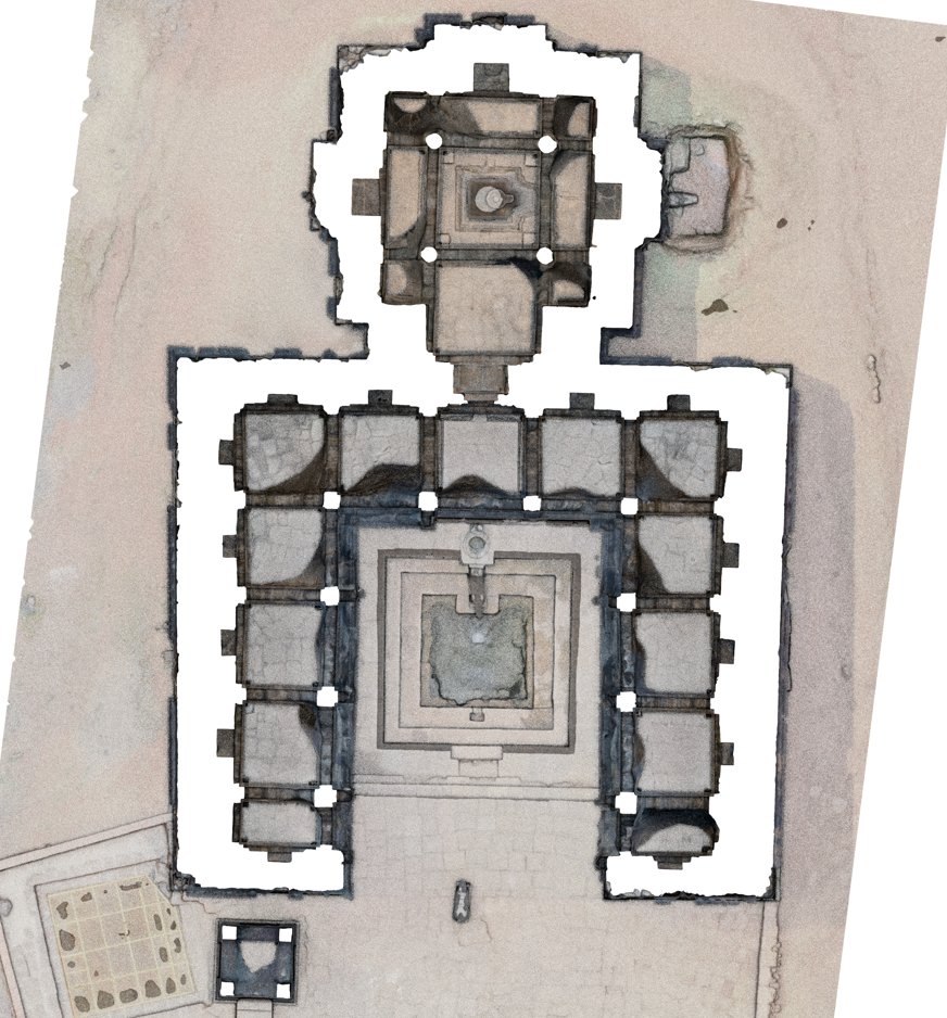
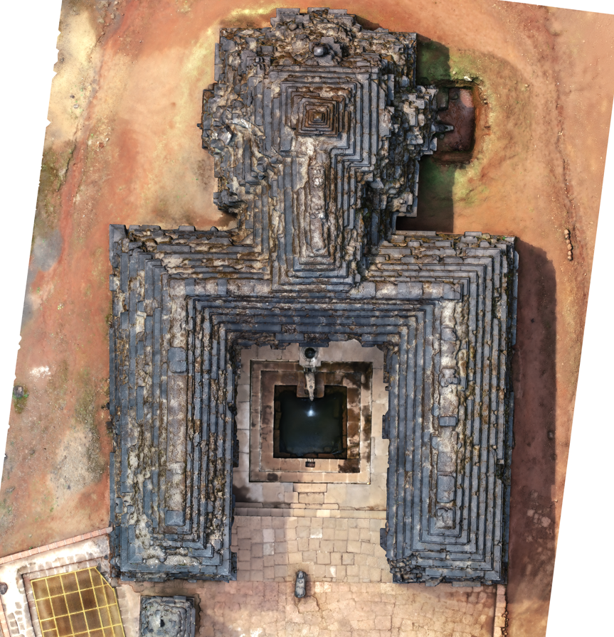
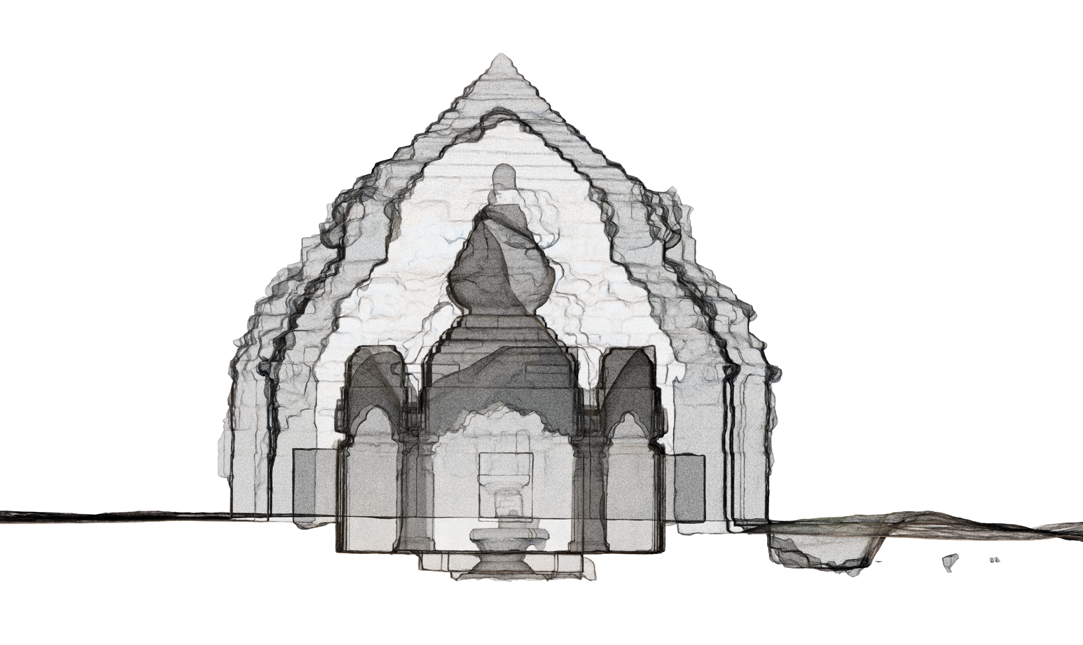
An orthographic projection drawing of the house’s one side is called an elevation drawing. An elevation drawing’s functions include providing vertical height measurements and depicting the finished aspect of a certain side of the house. Each side of the house is often given four elevations, one for each side. Distance above sea level is known as elevation. Elevations are often expressed in feet or metres. On maps, they can be represented by contour lines that link points of the same elevation, by colour bands, or by numbers that indicate the precise elevations of specific places on the Earth’s surface.