**Who We Are**
A R Enterprises is not just a company; we are your strategic partner in unlocking the full potential of drone technology for mapping and surveying. With a rich history of delivering successful projects and a team of seasoned professionals, we stand as a testament to reliability and quality in the rapidly evolving world of geospatial services.
**What Sets Us Apart**
1. **Expertise: ** Our team comprises skilled professionals with a deep understanding of drone technology, mapping techniques, and data analysis. We leverage this expertise to provide accurate and insightful mapping solutions tailored to your specific requirements.
2. **Cutting-Edge Technology:** We stay ahead of the curve by investing in the latest drone technology and software tools. This ensures that our clients benefit from the most advanced and efficient mapping solutions available in the market.
3. **Comprehensive Services:** A R Enterprises offers a wide range of drone mapping services, including but not limited to:
– **Land Surveying:** Precise and efficient land surveying services for construction, development, and real estate projects.
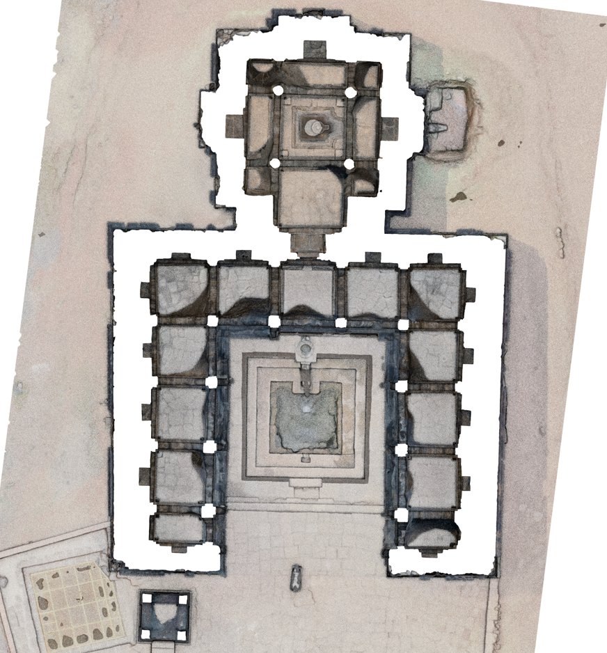
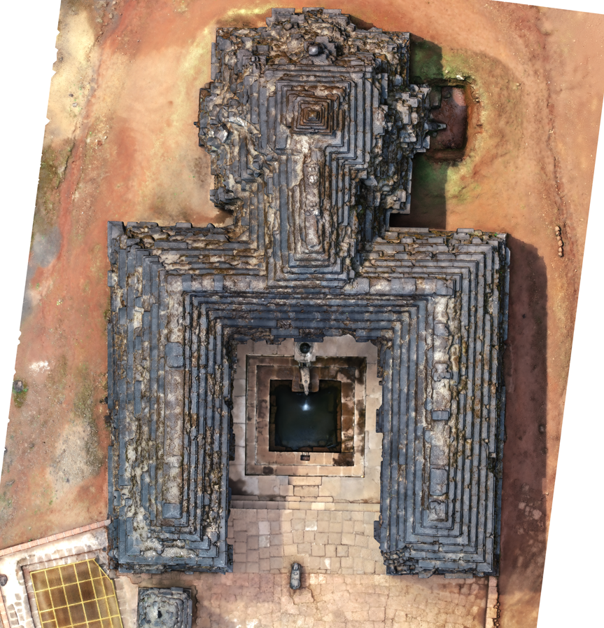
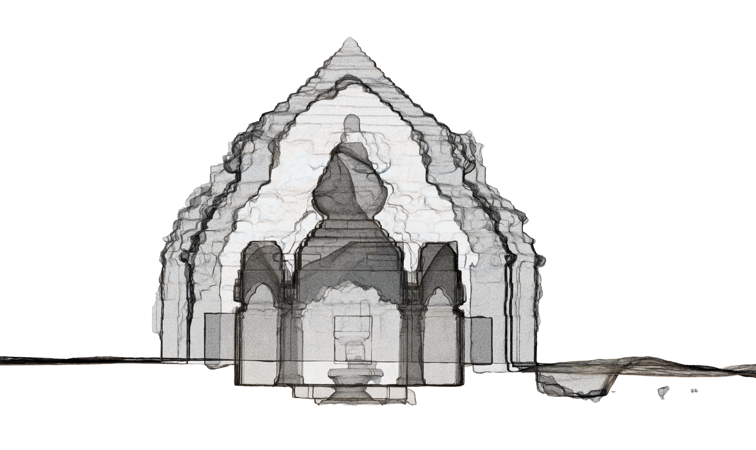
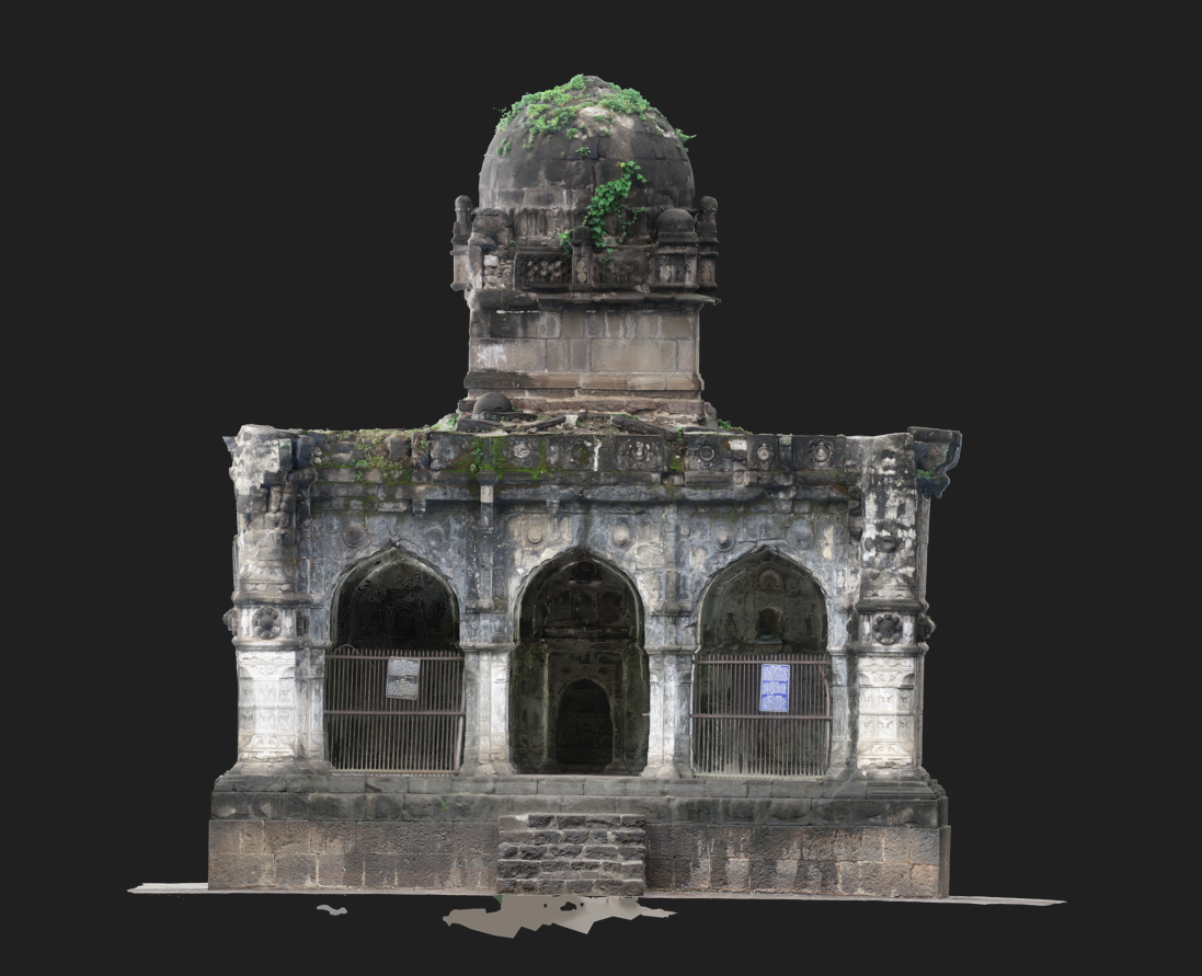
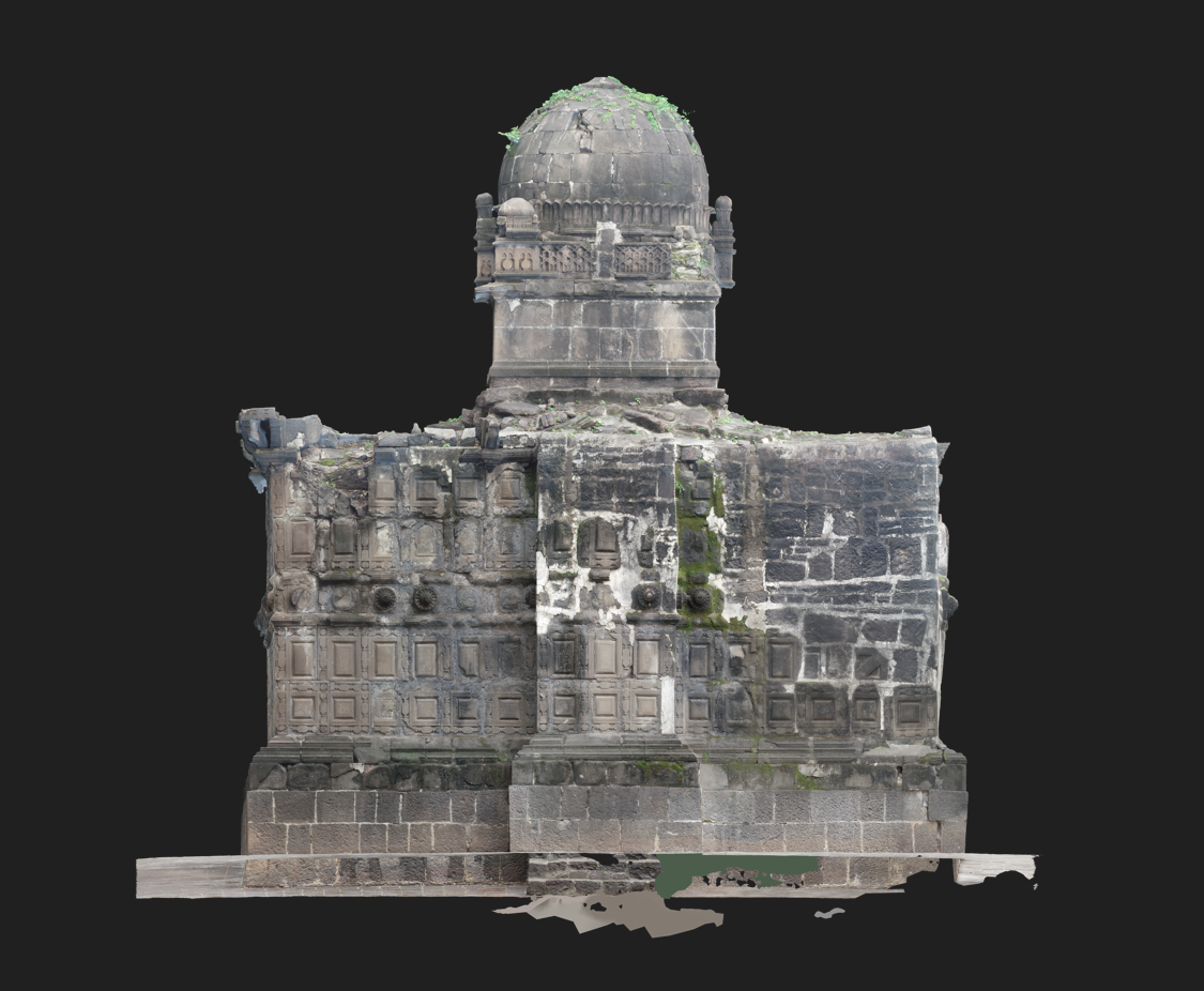
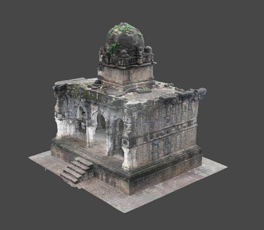
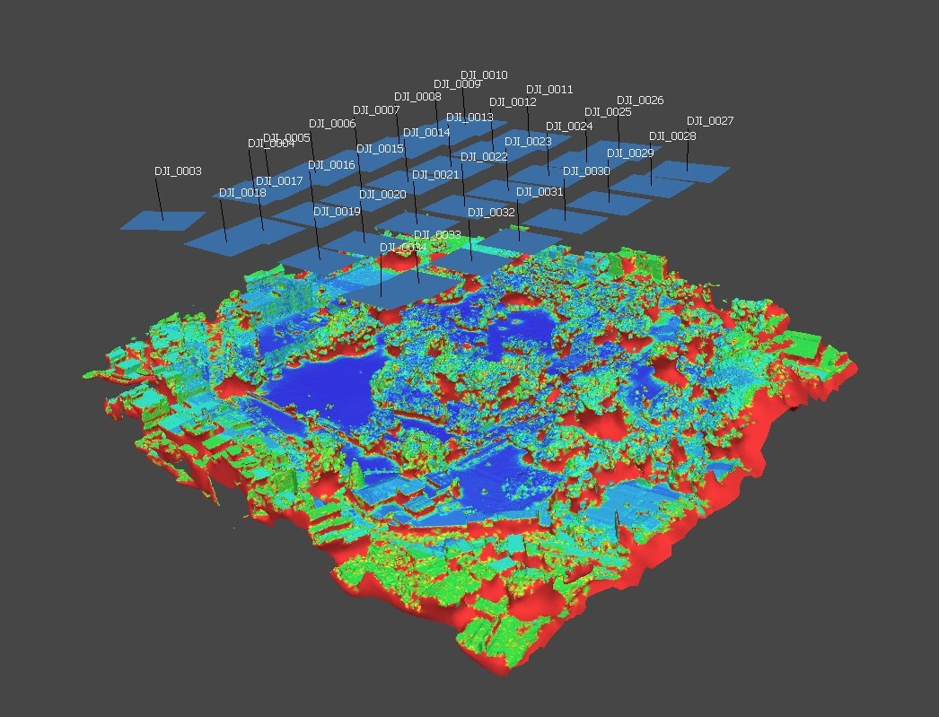
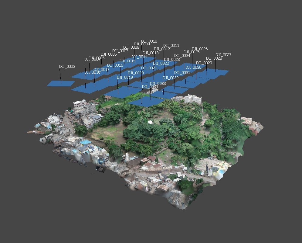
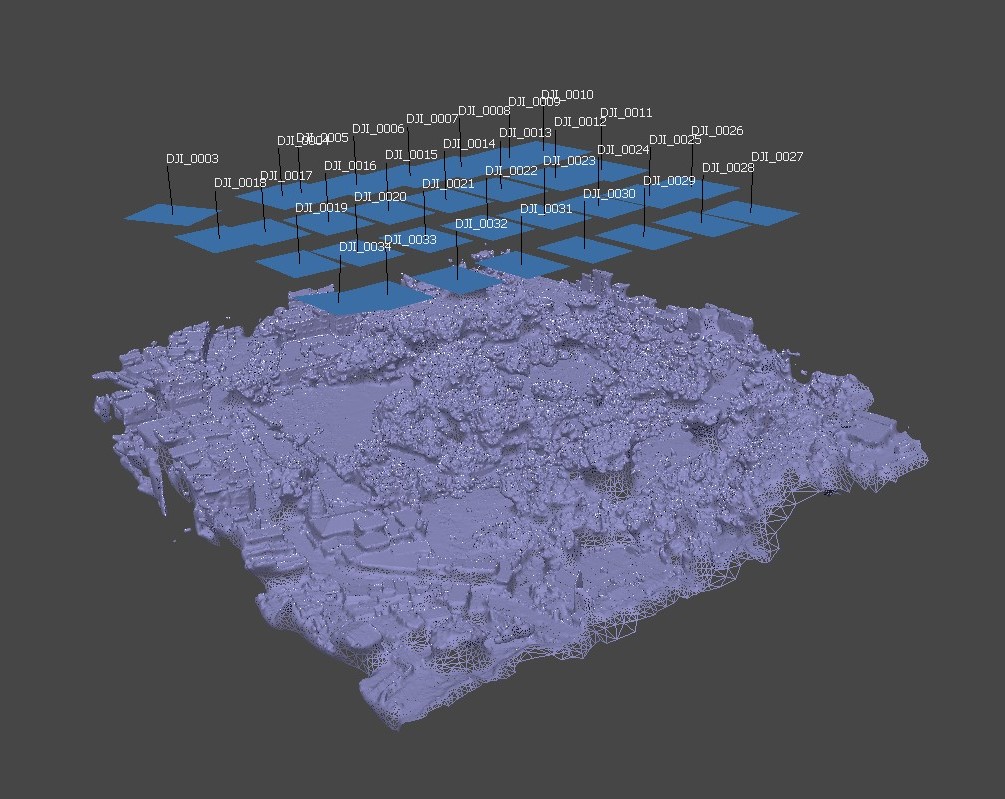
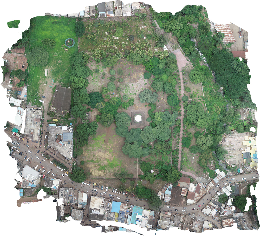
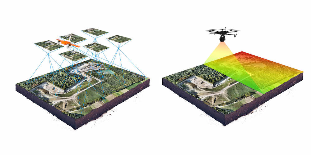
– **3D Modelling:** Transforming landscapes into detailed 3D models for enhanced visualization and planning.
– **Topographic Mapping:** Accurate mapping of terrain and elevation for various applications, from infrastructure planning to environmental management.
– **Agricultural Assessments:** Providing farmers with valuable insights through drone-based monitoring of crops and land.
– **Drone Observation:** Leveraging drones for detailed observation and data collection in various industries.
– **Virtual Reality and 360-Degree Panorama Shooting:** Immersive experiences for enhanced visualization and presentation.
– **3D Mapping GIS Services:** Cutting-edge Geographic Information System (GIS) services for comprehensive spatial analysis.
– **Elevation Work:** Precise elevation mapping for construction, environmental, and infrastructure projects.
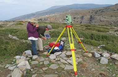
– **Total Station Survey Work:** Utilizing advanced surveying instruments for accurate and detailed measurements.
– **Aerial Inspection Service:** Comprehensive aerial inspections for infrastructure, utilities, and environmental monitoring.
**Why Choose A R Enterprises ? **
When you choose A R Enterprises, you are selecting a partner dedicated to elevating your project to new heights. Our commitment to quality, innovation, and customer satisfaction is the foundation of our success.Explore the possibilities with A R Enterprises, where the sky is not the limit – it’s just the beginning. Contact us today to discuss how our comprehensive drone mapping services can add value to your project.